Group Size: Maximum 8 Persons, Minimum 2 Persons
Tour Grading: Strenuous, Challenging and Difficult
Activity: Trekking, Nature, Culture, and Wellness
Sights: Paro Dzong, Thimphu Centenary Market, Kuenselphordang, Painting School of Arts and Crafts, Textile Museum, National Museum, Tiger’s Nest Monastery, Gunitsawa village, Sharna Zampa, Thangthangka, Jangothang, Lingshi, Chebisa, Shomuthang, Robluthang, Limithang, Laya, Rodhuphu, Narethng, Tarina, Woche, Lhedi, Thanza, Tshorim, Gangkar Puensum, Geshe Woma, Warathang, Duer Tsachu, Tshochenchen, Duer village, Bumthang, Trongsa, Punakha, Madman Temple, Paro.
Best Season: May, June, July, August, September and October
Trip Route:
Thimphu Paro Gunitsawa village, Sharna Zampa, Thangthangka, Jangothang, Lingshi, Chebisa, Shomuthang, Robluthang, Limithang, Laya, Rodhuphu, Narethng, Tarina, Woche, Lhedi, Thanza, Tshorim, Gangkar Puensum, Geshe Woma, Warathang, Duer Tsachu, Tshochenchen, Duer village, Bumthang, Trongsa, Punakha, Paro.
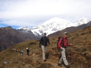
The Snowman Trek is an extension of the beautiful Laya Gasa Trek and leads from Laya into the high altitudes of the Bhutanese Himalayas. It takes tough and enduring trekkers into the Lunana region and further on to Gangkhar Puensum and Bumthang, or down to Sephu in the Trongsa district, depending on which route you choose. The Snowman Trek leads through the most remote areas up to very high altitudes.
If you would like to cut short trekking days, you have the option to start the trek from Gasa through Laya Village overnight and acclimatize for the next day’s vigorous trek.
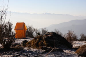
Trekkers have to camp at altitudes above 5,000m more than once, and depending on the seasonal temperatures, the camps are sometimes on snow.
The Lonely Planet describes the Snowman Trek as one of the most difficult treks in the world. The best time for the Snowman Trek is summer, unlike many other high-altitude treks in Bhutan. Many groups that attempt this tough trek do not finish due to problems with the high altitude or snow-blocked passes. However, those who make it will remember this trek as outstanding, beautiful, and one of the most rewarding treks of their lives. In this version of the Snowman Trek, one has the possibility of spending a day or two at perhaps one of the most beautiful hot springs in the Himalayas.
Trip Highlights
- The only capital in the world without traffic lights
- Buddha Dordenma (Kuenselphodrang)
- Bhutan Postal Museum, Evolution of Communication Systems in Bhutan
- Stunning views from the passes of Pele la and Yotong la
- Bumthang, the land of “Beautiful girls,"
- The Vanguard of the Warriors, Trongsa Dzong (fortress), Ta (watchtower) Dzong
- Chimi Lhakhang, the temple of fertility
- Punakha Dzong: Lavender, full bloom (seasonal)
- Tiger’s Nest: an exhilarating task of 2 hours of climbing and another 1.5 hours of retrieving steps
- Laya Village and the Life of Nomads,
- Hot Spring Therapy (wellness) in Duer Tsachu
Day 1: Arrive at Paro, drive to Thimphu
Upon arrival at Paro International Airport, you are greeted with a warm welcome and then drive off a few kilometers away to visit Paro Rinpung Dzong and take a short familiarization tour of Paro town. After an early lunch, drive to Thimphu, the capital.
Day 2: Thimphu sightings and evening drive to Paro
Post Office Museum and make customized stamps. The museum was established in November 2015 to commemorate the 60th birthday of the Fourth King. The museum tells the story of Bhutan’s development and progress over time. Methods such as anecdotes, artifacts, and the rich assortment of stamps the country has developed are used.
Centenary Farmers’ Market: Every Saturday and Sunday, most of the Thimphu population congregates on the banks of the river, where the weekend market is held. Here, villages from the valley and other nearby villages come to sell their agricultural products.
National Handicraft Emporium (various Bhutanese Arts and Textiles for sale) Owned by the government, the emporium has fixed-priced items with acceptance of credit cards. You can find items like traditional boots, bamboo baskets, festival masks, etc.
Tashichho Dzong in its present incarnation, was consecrated as late as 1969, and this building is a visual delight. Unlike other Dzongs, this “peacetime” one has three entrances: one for the common folk, leading to the administrative establishment; another to the monastic section, in whose courtyard Tsechu (festival) is performed annually.
In the evening, we will retrieve our steps back to Paro and spend time at leisure to acclimatize for the next day’s hike.
Overnight in the hotel.
Day 3: Hike to Taktshang (the Tiger’s Nest)
By now, we may have acclimatized to preparing to walk up to the famous Tiger’s Nest. The monastery is the most famous in Bhutan and has recently been listed as one of the ten holiest places in the world. This is one of the highlights of the trip.
It’s perched on a high cliff, 900 meters above the floor of Paro Valley. It is named Tiger’s Nest because Guru Rimpoche is said to have flown to the site on the back of a tigress in the 8th century. This monastery is the holiest in Bhutan. The five-hour walk to the monastery, involving some intense but rewarding climbing over 900 meters, cleanses both the soul and the body.
Overnight in the hotel.
Day 4: Trek from Sarna (start point) to Soi Thangthangka
Soi Thangthangka (3,610m), approximately 22km. 8-hour trek, 770m ascent, 10m descent
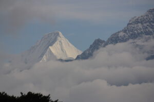
From Paro, we drive north to Drugyal Dzong and then continue driving to Shana Zam (2850m). After loading the pack of animal ponies with your luggage, trekking gear, and supplies, we begin a 3- to 4-hour trek through Jigme Dorji Wangchuk National Park. Accompanying the group are the horseman, ponies, a guide, a cook, and assistants. On this long day, the trail continues with lots of small ups and downs. After going uphill through the river valley, the valley finally narrows gradually to a mere path that descends to a meadow where a camp will be set up. From here, if weather permits, you will have the first great view of Mt. Jumolhari.
Overnight in the tent.
Day 5: Trek to Jangothang
Jangothang (4,080m) Approx. 19km, 5–6 hours trek, 480m ascent
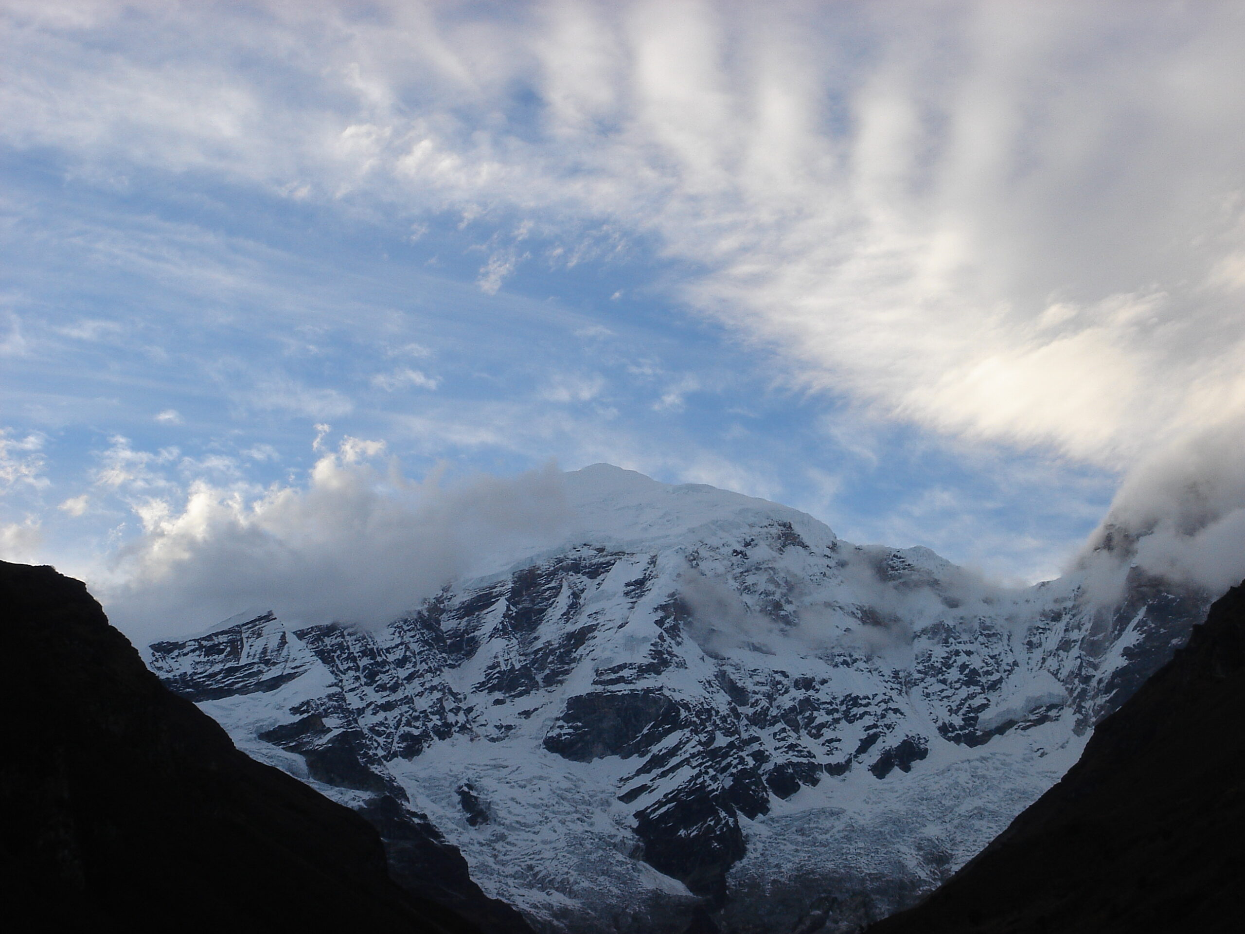
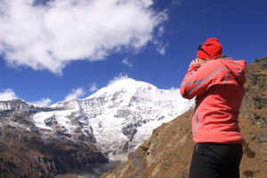
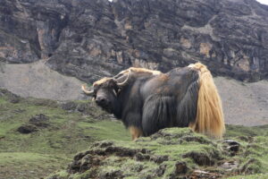
If you did not see Mt. Jomolhari the previous evening, you will still have a chance to get a great view early this morning. This morning, the trek continues up the Paro Chhu valley, which widens into patches of alpine meadows and scanty growths of forest. You will cross an army checkpoint along the way and enjoy a spectacular view of high mountain ridges and snow-capped peaks. In this area, yaks and their herder’s homes become a regular feature of the landscape.
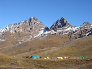
Passing the villages of Soe, Takethang, and Dangochang is another asset on this day. After reaching Jangothang, one of the most beautiful campsites in the Himalayas, you will again have a spectacular view of Mount Jomolhari.
Overnight in the tent.
Day 6: Jangothang (halt)
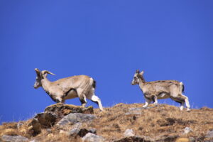
The rest day in Jangothang provides plenty of possibilities for day hikes with great views of lakes and snow-capped mountains such as Jomolhari and Jichu Drake. There are good chances to spot some blue sheep on the upper slopes of the valley. Jangothang is the perfect environment for your acclimatization. You can also trek up to Tosoh or hike around the area. There are good, short hiking trails in three directions. Jomolhari and its subsidiary mountain chains lie directly west, Jichu Drake to the north, and there are several unclimbed peaks to the east.
Overnight in the tent.
Day 7: Trek to Lingshi
Lingshi (4,010m): approximate distance 18km, 7 hours trek, 840m ascent and 870m descent
This is one of the longest days of the trek. A short distance from the camp the trail begins climbing rapidly for about half an hour and then becomes a gradual ascent to the Nyilila pass at 4,870m. While on the climb, enjoy the surroundings. You might see herds of blue sheep grazing on the slopes of the mountains. From the pass, you will have spectacular views of Mt. Jomolhari, Jichu Drake, and Tsherimgang, all of them rising above 7,000m.
It’s a gradual descent to the camp, where you will pass by some of the yak herder’s tents, made from yak wool. The herders use these tents while traveling to various pastures for their yaks. As you come down into the Lingshi basin, a beautiful U-shaped valley, you get a wonderful view of Lingshi Dzong on clear days. Tserimgang and its glaciers rise at the north end of the valley. The campsite is next to a stone hut you reach just before Lingshi Dzong.
Overnight in the tent.
Day 8: Trek to Chebisa
Chebisa (3,880m): approximately 10km, 5 hours of trekking, ascending 280m and descending 410m
Today is one of the shortest walking days, and you can take it easy. In the morning, you may hike to the Dzong (local administrative office and monastic center), descend to visit the Lingshi village, and then continue the trek to Chebisa. Pass through picturesque Goyul village with unusually clustered stone houses at an altitude of 3870m and arrive at the spectacular Shangri-like setting of Chebisa village. Your campsite is near the village, opposite the river.
Overnight in the tent.
Day 9: Trek to Shomuthang
Shomuthang (4,220m) | Approx.: 17km 7 hours trek, ascend 890m and 540m descent
The morning starts with a long ascent behind Chebisa Village (2–3 hours) through a wide pastureland towards Gobu La (pass). On the way, you will see a few people herding yaks. There is also a great chance to spot large herds of blue sheep above the trail. After crossing Gobu La (4,410m), you descend into the valley, then climb again a little bit before descending again to Shakshepasa (3,980 m), a large U-shaped valley.
Climbing from here, you will finally reach the campsite at Shomuthang, above a river that is a tributary of the Nochu River.
Overnight in the tent.
Day 10: Trek to Robluthang
Robluthang (4,160m): approx. 18 km (7 hours) trek, ascend 700m and descend 760m
You begin by climbing up the valley to view Kang Bum (6,526 m) and some edelweiss. After two hours of climbing, you will reach Jhari La (4,750m), from where you catch the first glimpse of Sinche La, the pass you will have to cross the day after. The big snow peak in the north is Gangchhenta (6,840 m), better known as the Great Tiger Mountain. If the weather is clear, Tserim Kang and the top of Jomolhari will be visible. The camp by the river is called Tsheri Jathang and is located in a beautiful, wide, and remote valley. Herds of takin, the Bhutanese national animal, migrate to this valley in the summer and remain for about four months. The valley has been declared a Takin sanctuary. Climb up a little bit, and you will reach the campsite at Robluthang in a rocky meadow.
Overnight in the tent.
Day 11: Trek to Limithang
Limithang (4,140m): approximately 19km, 7 hours of trekking, 850m ascent, and 870m descent
The trek starts with an initial 40–60-minute ascent before gradually rising for another 1.5 hours through a boulder field. It is then a 1-hour steep ascent before reaching Sinche La (5,005m), the final and highest pass on the trek, if you don’t intend to continue the Snowman trek from Laya onwards.
As you descend the far side of the pass, you will see an impressive terminal moraine and a glacial lake at the foot of the valley. You can see classic examples of lateral moraines where the glacier has pushed rocks up both sides of the valley. Below the moraine, you cross the Kango Chhu and soon reach the Limithang campsite. The peak of Gangchhenta towers over the campsite, even though it’s quite a distance away.
Overnight in the tent.
Day 12: Trek to Laya
Laya (3,840m) | Approx.: 10km 5 hours trek, 60m ascend & 340m descent
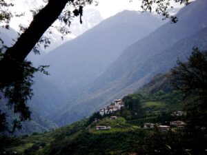
Today, you walk downhill along a narrow, winding river valley. After a long time, the trail takes you through a densely forested region. The trail leads you to the west side of Laya village. From the west of the village, you will have spectacular views of Mt. Gangchhenta and Mt. Masagang. The village center is a community school and has a basic health unit with a telephone connection.
Overnight in the tent.
Day 13: Laya halt
The extra day in Laya is to get some rest, explore, and meet the locals. Laya is a largely isolated community of roughly 1000 people, who have their own language, customs, and distinct dress. The women keep their hair long (unusual in Bhutan, where most women have close-cropped hair) and wear conical bamboo hats with a spike at the top. They dress in a black Yak wool jacket and skirt with some colored stripes. Their jewelry includes an array of silver teaspoons at the back. The village is spread out over the hillside, close to the Tibetan border at an altitude of 3700m, and is one of the highest villages in Bhutan.
Overnight in the tent.
Day 14: Trek to Rhodophu
Rhodophu (4,160m): approx. 19 km, 8 hours trek, 1,030m ascents, and 750m descent
From Laya, we descend to an army camp and continue following the river till the turn-off point to Rhoduphu. After lunch, the climb continues through rhododendron bushes till you reach the camp at Roduphu, just next to the Rhodu Chhu.
Overnight in the tent.
Day 15: Trek to Narethang
Narethang (4,900m) | Approx. 17km, 6 hours trek, 740m Ascent
After following the river for about half an hour, you will have a steady climb to a high, open valley at 4,600m and then further up to Tsomo La (4,900m). Tsomo La offers a superb view of Lunana, Mount Jomolhari, Jichu Drake, and the Tibetan border. The route then crosses a flat, barren plateau at about 5,000m. The campsite at Narethang is towered by the peak of Gangla Karchung (6,395m).
Overnight in the tent.
Day 16: Trek to Tarina
Tarina (3,970m): approximately 18km, 6 hours of trekking, 270m ascents & 1,200m descent
From the camp, you will climb for about an hour to Gangla Karchung La (5,120m). The view from the pass is breathtaking, and the whole range of mountains, including Jekangphu Gang (7,100m), Tsenda Kang, and Teri Gang (7,300 m), can be seen. The pass descends along a large moraine. Again, one has great views: a massive glacier descends from Teri Kang to a deep turquoise lake at its foot. Up here, a glacial lake burst through its dam in the early 1960s, causing widespread damage and partially destroying Punakha Dzong. Finally, it is a very long descent through the thick rhododendron to Tarina Valley, where you will find several good campsites along the Tang Chhu.
Overnight in the tent.
Day 17: Trek to Woche
Woche (3,910m): approximately 17 km, 7 hours of trekking, 270m ascents and 330m descent
The walk leads down through conifer forests, following the upper ridges of the Pho Chhu, and passing some impressive waterfalls. The trail then climbs over a ridge and drops to Woche, a settlement of a few houses, the first village in the Lunana region.
Overnight in the tent.
Day 18: Trek to Lhedi
Lhedi (3,700m): approx. 17 km, 7 hours trek, 980m ascent, and 1,190m descent
The trek starts through juniper and fir forests, and further ahead, through rhododendron bushes. Climb up to Keche La pass (4,650 m), where one can have a great view of the surrounding mountains again. After the pass, descend to the riverside, walking through a village with a stunning view of Table Mountain and others. Follow up the river till Lhedi Village. There is a basic health unit, a school, and a wireless telephone connection.
Overnight in the tent.
Day 19: Trek to Thanza
Thanza (4,150m) | Approx. 17 km, 8 hours trek, 450m ascent
In clear weather, you will have great views of Table Mountain (7,100m). Around lunchtime, you will pass the small village of Chozo (4,090 m), which has a dzong still in use. Reaching Thanza again, you will have a great view of Table Mountain, which forms a 3,000-meter-high wall of snow and ice behind the village. Although there are possibilities to camp directly at Thanza, most groups prefer to camp in Thoencha.
Overnight in the tent.
Day 20: Thanza halt
In Thanza, walk around and experience some village life, or climb up the ridge for fascinating views of lakes and mountains. But as it takes time to arrange new yaks (the yaks from Laya will not go further than Thanza), you might have to spend one day at Thanza anyway.
Overnight in the tent.
Day 21: Trek to Tshorim
Tshorim (5,120m): approximate 9-hour trek
Having chosen the route to Bumthang, the trek starts by climbing a ridge with a great view of Table Mountain and Thanza Valley below. The ridge altitude is 4,500 m, and it rises gradually up to 4,650m. After lunch, walk upwards towards the left side of the bridge to enjoy the view of snow-capped mountains. You reach the campsite at Tshorim after climbing more ridges.
Overnight in the tent.
Day 22: Trek to Gangkar Puensum (Base Camp)
Gangkar Puensum (Base Camp) (4,970m): approximate 7-hour trek
This is one of the highlights of the trek, and the day starts with a short climb to the Tshorim tsh0. You walk on the side of the lake, enjoying a panoramic view of the Gophu La ranges. The last climb to the Gophu La pass (5,230m) is very short. After the pass, descend to the base camp, walking along the ridge to enjoy a great view of Gangkhar Puensum. If interested, one can divert to the left side to climb up the pyramid peak for a better view, or you can go down to the base camp nearby, Sha Chhu.
Overnight in the tent.
Day 23: Trek to Geshe Woma
Geshe Woma (4,200m): approximate 7-hour trek
The trail further follows the Sha Chhu and descends gradually to Geshe Woma.
Overnight in the tent.
Day 24: Trek to Warathang
Warathang (4,000m): approximately 9-hour trek
The path continues following Sha Chhu for two and a half hours until the stiff climb to Saka La begins. Visibility along the Saka La trail is poor, so one must see the top of the ridge for guidance. After having lunch near a yak herders’ camp, you climb up to Saka La (4,800m). The path then descends to a couple of lakes, and another short ascent is stunning. The scenery once again is beautiful, with small lakes and mountain peaks.
Overnight in the tent.
Day 25: Trek to Duer Tsachu
Duer Tsachu (3,590m): approximately 5 hours
A one-hour climb leads to Juli La (4,700m). After the pass, you descend to the riverside through dense rhododendron, juniper, and conifer forests. After the bridge, a short climb leads to Duer Tsachu. These hot springs, where Guru Padmasambhava is supposed to have taken a bath, might be the most stunningly beautiful hot springs in the Himalayas. You might want to spend an extra day at Duer Tsachu.
Overnight in the tent.
Day 26: Trek to Tshochenchen
Tshochenchen (3,850m): approximate 9-hour trek
From the hot springs, it is a long and steady climb again, with great views of the mountains in Lunana. You will also come across blue lakes and yak herder huts.
Overnight in the tent.
Day 27: Duer Village (trek end point) - Bumthang
This is the last day of the trek, and your porters change from yaks to horses. The path follows the Chamkhar Chhu, descending gradually with a few climbs in between. The trek ends here when you arrive at Duer village. From here you drive to Jakar (Bumthang) and spend the rest of the day at leisure with a nice hot bath and good food after so long.
Overnight in the hotel.
Day 28: Explore Bumthang
After a pleasant breakfast, we will take it lightly and visit some sights, depending on your area of interest. Some of the key sights could be:
Jakar Dzong was initially built as a monastery and later converted to a Dzong in 1646. Scenically located on the crest of a hill spur, it overlooks the Choekhor valley. This “Dzong of the White Bird” was named by Zhabdrung’s great-grandfather, Lam Ngagi Wangchuk, because one day, while building the monastery, a great white bird flew directly over the site and landed on this spur. Interpreting this as an auspicious omen, the site of the monastery was immediately shifted, and it was later converted into a Dzong.
Jambay Lhakhang was supposedly constructed on the same day as Kyichu Lhakhang in Paro by the Tibetan ruler Songsten Geonpo as part of his successful effort to subdue the ogress, preventing the spread of Buddhism. It was one of the strategically located temples and was placed on the left knee of the ogress “to subjugate the frontiers.". The annual Jambay Lhakhang Drup is held here every October and is one of the most spectacular festivals in the country. A highlight is the fire dance performed to bless infertile women so that they may bear children.
Kurjey Lhakhang is the country’s most historical holy place. The complex is surrounded by 108 chortens, transforming it into a three-dimensional mandala patterned on the lines of the Samye Monastery in Tibet. “Kur” means body, and “jey” means print. It is here that Guru Padmasambhava meditated when he first visited the country, leaving an imprint of his body on the rock enshrined here. The Kurjey Tsechu is held in June and includes a spectacular masked dance symbolizing Guru Padmasambhava, and his eight manifestations are also unfurled during the event.
To visit Tamzhing Lhakhang, you have to leave the town over the bridge spanning Bumthang Chhu, turn left, and drive around 5km. This Lhakhang was founded in 1501 by Pema Lingpa, who was personally involved in its construction. It took four years to build, and even today it remains, along with Gangtey Goemba, the premier center for teaching Pema Lingpa’s tradition of Buddhist studies.
Mebar Tsho, a short 11-kilometer drive to the Tang Valley, is the site of some of Pema Lingpa’s greatest finds. Maebartsho, or “Flaming Lake,” is one of the great pilgrim sites of Bhutan. The 27-year-old Pema Lingpa found several of Guru Rinpoche’s terms here.
Overnight in the hotel.
Day 29: Drive to Punakha (en route Trongsa)
Today will be a pretty long drive, with almost 8 hours on the road. We will drive via Trongsa, where we can stop for lunch. Time permitting, visit:
Trongsa Dzong, possibly the most impressive in the country, is intricately layered into the hillside, in complete harmony with its surroundings. The structure is aesthetically designed, and its clean lines boast a superb sense of proportion and space, while finely carved woodwork and elegant paintings suitably embellish it.
Ta Dzong: Clamber up to Ta Dzong, which is now being converted into a museum. It has an unusual tower section with wings extending in front of the main building. Entering this, visit the chapel dedicated to Jigme Namgyal and enjoy a bird's-eye view of the Dzong stretched out below.
Upon arrival in Punakha, settle down for a quiet dinner and call it off for the day.
Overnight in the hotel.
Day 30: Paro
Explore Punakha and Drive to Paro in the evening
In the morning, visits to Punakha Dzong Built in 1637, the Dzong continues to be the winter home for the clergy, headed by Chief Abbott, the Je Khenpo. It is a stunning example of Bhutanese architecture, sitting at the fork of two rivers, portraying the image of a medieval city from a distance. The dzong was destroyed by fire and glacial floods over the years but has been carefully restored and is, today, a fine example of Bhutanese craftsmanship.
Chimi Lhakhang, a twenty-minute walk across terraced fields through the village of Sopsokha from the roadside to the small temple located on a hillock. Ngawang Chogyel built the temple in the 15th century after the “Divine Madman” Drukpa Kuenlay built a small chorten there. It is a pilgrim site for barren women. After an early lunch, drive to Paro En route, stop at Dochula Pass to see the 108 chortens built by the present Queen Mother, HM Ashi Dorji Wangmo Wangchuck, to commemorate Bhutan’s victory over Indian militants and to liberate the souls of the ones lost. On a clear day (only really likely between October and February), the pass offers a panoramic view of the Bhutan Himalayas. In Paro, check into a hotel and spend the evening at leisure
Overnight in the hotel.
Day 31: Departure
After an early morning breakfast, depending on the flight schedule, drive to Paro International Airport for departure to the onward destination and bid farewell.
'Tashi Delek'

